

Extreme Weather
Cold Night Shelters ║ Hot Weather Resources ║ Hurricane and Storm Resources
Weather Update
Many of you may already be monitoring the approaching system however we wanted a share an update from Pinellas County Emergency Management (PCEM).
A weak area of low pressure is forecast to form in the Eastern Gulf waters over the next few days. Combined with increased deep moisture, this weather system is forecast to produce 6” – 8” of rainfall across Pinellas County over the next seven days, with majority of the heaviest rainfall occurring Sunday (07/19) through Tuesday (07/21).
The National Hurricane Center (NHC) has given this area a 20% chance of developing into a tropical depression within the next seven days.
The Weather Prediction Center (WPC) has placed Pinellas County in a Marginal Risk (Level 1 / 4) for excessive rainfall and flash flooding starting Sunday (07/19) through Tuesday (07/21).
Pinellas County Emergency Management (PCEM) recommends everyone review emergency plans and share forecast information/messaging with residents, partners, and their communities. Biggest Concerns/Impacts:
6” – 8” of rainfall with isolated higher amounts will be possible across Pinellas County through the next seven days (07/16 – 07/23), with most of the rain falling Sunday (07/19) through Tuesday (07/22).
Isolated flooding (including localized flash flooding) will be possible during prolonged periods of very heavy rain, especially in areas with poor drainage.
Even if the system develops into a Tropical Depression, the primary impact from this system for Pinellas County will be heavy rainfall and isolated flooding issues.
Hurricane and Storm Resources
Alert Pinellas: https://pinellas.gov/alert-pinellas
Pinellas County Hurricane Resource Guide in English, Spanish, and Vietnamese
Pinellas County Information Center: 727-464-4333
National Hurricane Center: www.nhc.noaa.gov

Hot Weather Resources
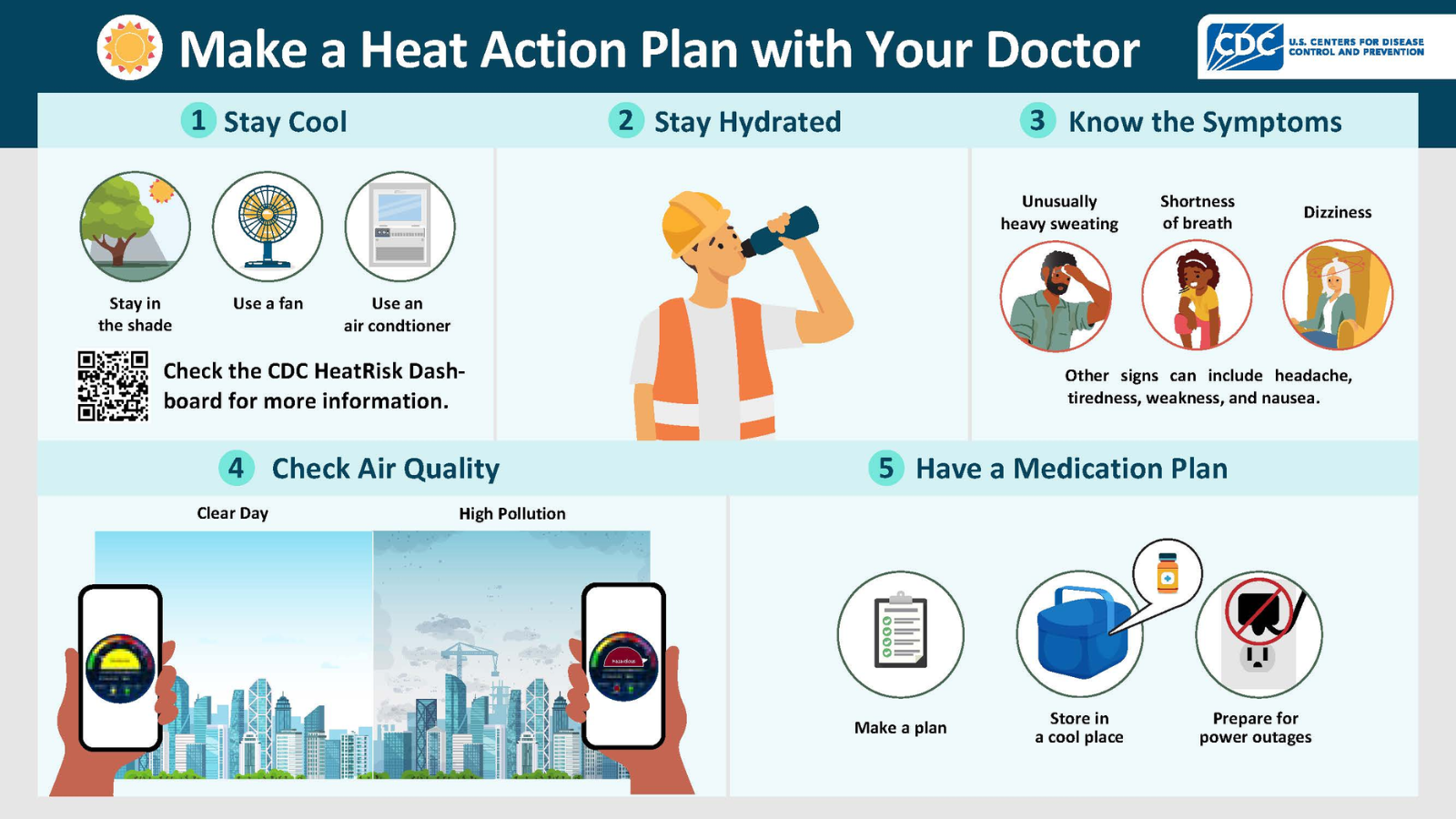
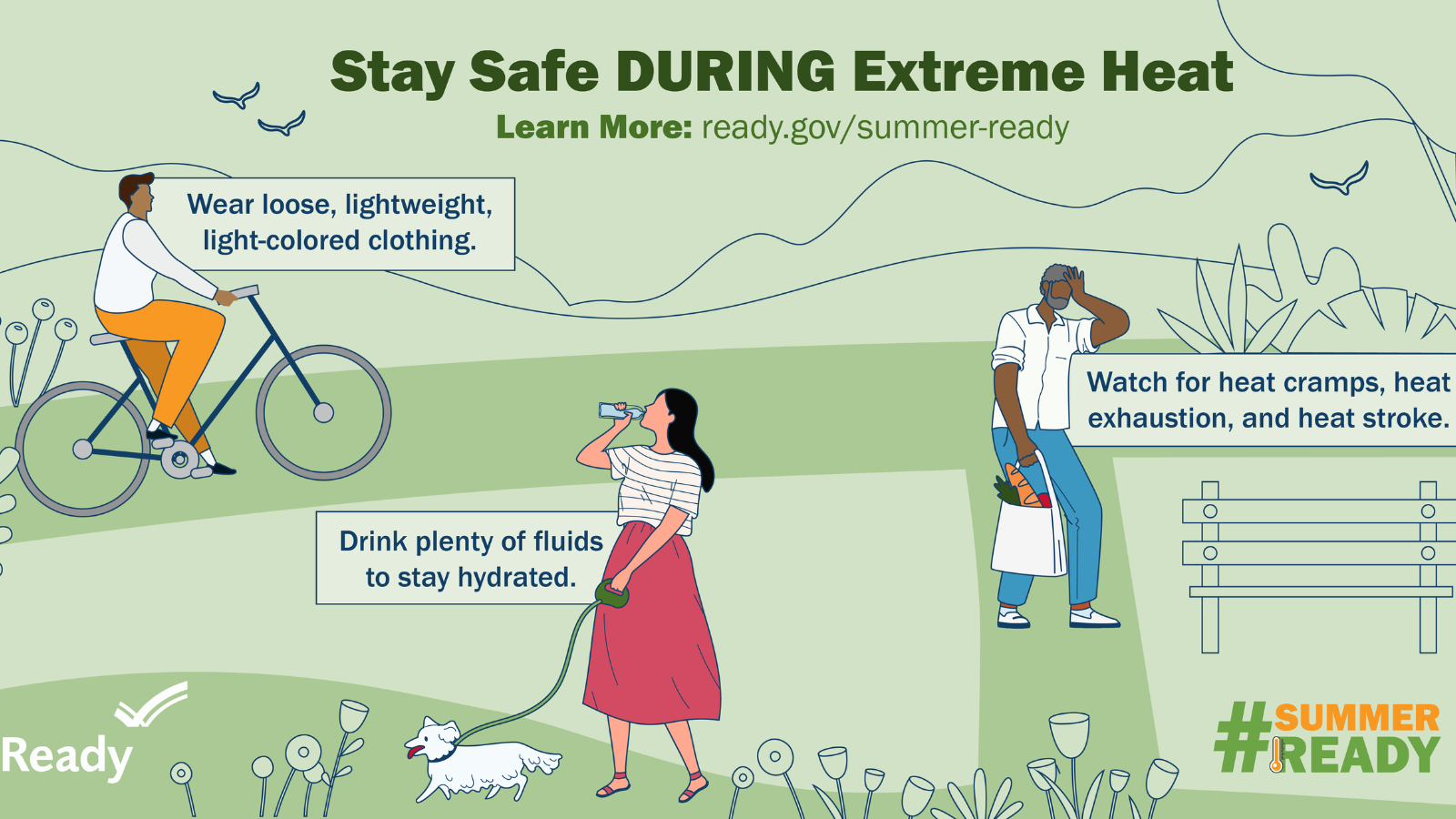
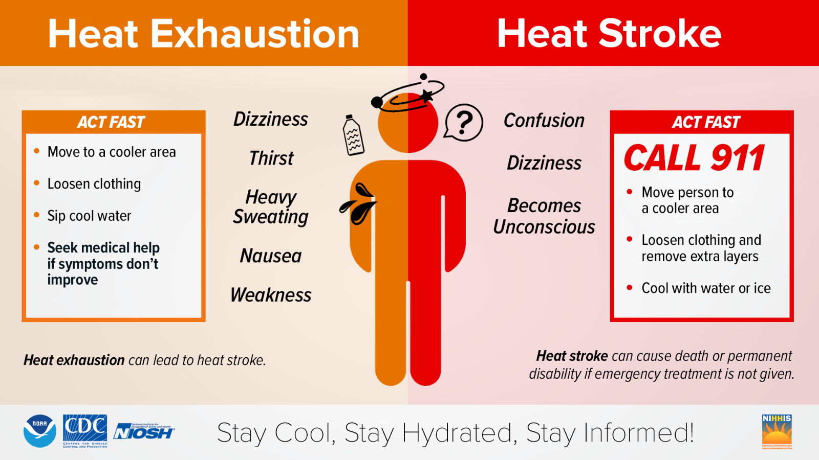
The Florida Department of Health says that “Extreme heat is one of the leading weather-related causes of death in the U.S., and Florida is particularly vulnerable due to its long summers and high humidity. These conditions can overwhelm the body’s cooling system, leading to heat-related illnesses like heat exhaustion and heat stroke, especially for vulnerable populations such as the elderly, children, and those with pre-existing health conditions.” Resources below are intended to help lessen the impact of Florida’s extreme heat.
Tips for People Experiencing Homelessness During Extreme Heat from the National Integrated Heat Health Information System:
Avoid strenuous activity during the warmest part of the day
Use a buddy system when working in extreme heat, and take frequent breaks
Dress in loose-fitting, lightweight, and light-colored clothes that cover as much skin as possible. Avoid dark colors because they absorb the sun’s rays
Protect your face and head by wearing sunblock and a wide-brimmed hat
Work with your support network if you have one - neighbors, family and friends - to monitor and address your heat-related needs - have them check in with you regularly to ensure you are safe and healthy
Read the side effects of any medications and talk with your doctor about how heat exposure will interact with them
Know the phone numbers and locations for local medical facilities, such as hospitals, to create contingency plans if you cannot access a cooling center, or need more help
Safety Information:
Resources:
Aquatic centers, pools, splashpads, and swimming within Pinellas County and the cities of Clearwater, Dunedin, Largo, Madeira Beach, Oldsmar, Pinellas Park, Seminole, St. Pete Beach, St. Petersburg, and Tarpon Springs
Libraries within Pinellas County, Pinellas County Library Cooperative
Cold Night Shelters
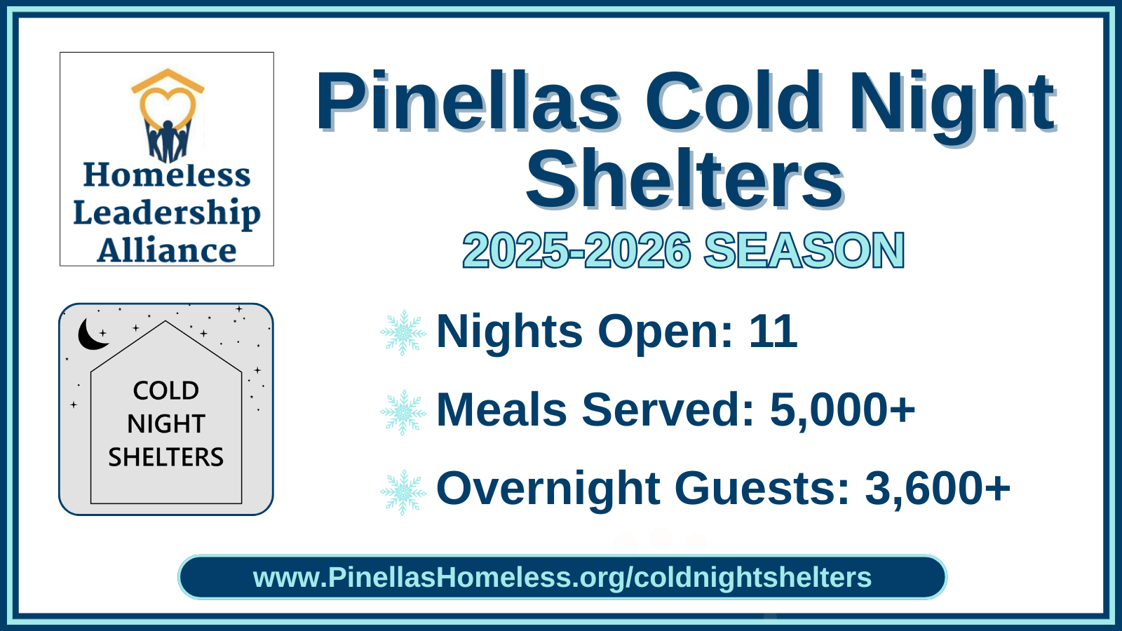
Pinellas Cold Night Shelters are a lifesaving program that provide those in-need with a warm, safe place to sleep on the coldest nights of the year. The Homeless Leadership Alliance of Pinellas (HLA) activates Cold Night Shelters when the National Weather Service predicts the “feels like” temperature will reach 40-degrees or colder between 6pm and 6am across Pinellas County.
Pinellas Cold Night Shelters are nontraditional, “pop-up” shelters inside of local churches, community centers, and emergency shelters. Pinellas Cold Night Shelters are located in Tarpon Springs, Clearwater, Pinellas Park, Kenneth City, and St. Petersburg. Each location provides guest with a blanket and mat, and many locations provide meals and additional supplies. When activated, Pinellas Cold Night Shelters are open between 6pm and 6am.